download pdf of this page
Work by:
Stefano Marras
(marras.stefano@gmail.com)
Ph.D., Department of Sociology and Social Research,
UniversitÓ degli Studi di Milano-Bicocca, Milano (Italy)
the note by Father Renato Kizito Sesana on his blog
 
PeaceReporter, 16/09/2009: Kenya,
iniziato lo smantellamento del pi¨ grande slum africano
La baraccopoli di Kibera dovrebbe diventare unÆarea residenziale entro i prossimi
cinque anni
|
|
|
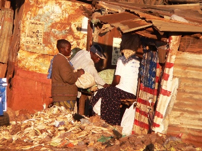
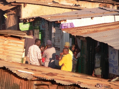
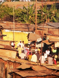
Kibera is known as one of the biggest informal urban settlements in the world. A number of actors (Government of Kenya and local authorities, NGOs, CBOs, scholars, mass-media) have provided and published over the years growing estimates of the dimensions of the population of the Kibera slum: most of them state that it is the largest slum in Africa with a number of people reaching now over 1 million. Some other say it is the second largest slum after Soweto in South Africa.
According to Mike Davis, one of the best known and respected scholars dealing with urban slums, Kibera has got a population of about 800,000 people (1). International Housing Coalition (IHC), an international NGO, states that "the Kibera slum in Nairobi has more than half a million people packed into 225 hectares [2.25 sqKm] (2,000 people per hectare [200,000 people per sqKm])." (2)
All these and other countless estimates posted on the internet refer in turn to numbers and statistics released by the Government of Kenya and UN-Habitat (the United Nations' Agency for Human Settlements). This latter has released several estimates ranging between 350,000 and 1 million people:
"Kibera in Nairobi, Kenya, is the second largest slum in Africa with a population of approximately 700.000 inhabitants (there is no census has been carried out in Kibera and hence estimates vary between 350,000 to one million)" (3)
"An estimate of total population in the settlement ranges from 500,000 to 700,000 inhabitants: densities of over 2000 people per ha [200,000 people per sqKm], making it one of the most densely populated informal settlements in the city." (4)
"Kibera is the largest slum in East Africa with a population in excess of 700,000 covering an area of 210 hectares [2.1 sqKm]" (5)
"[à] in Kibera, the largest contiguous area of slum settlements, about 750,000 to a million inhabitants live on less than 225 hectares [2.25 sqKm] of land. This makes Kibera the largest most crowded and appalling slum settlement in Africa." (6)
These statistics mainly come out of guesses based on the analysis of aerial pictures of the slum. The only field survey officially carried out so far by authorities dates back to 2003-2004, when, in the framework of the Kenya Slum Upgrading Programme (KENSUP), Government of Kenya and UNHabitat carried out the physical mapping and took the census of Soweto East, one of the 13 villages that compose Kibera. The outcomes of this census have never been released to the public. (7)
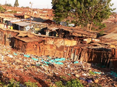
Therefore, we can say that no reliable data about the dimensions of the Kibera informal human settlement is available to this day. This is due to the fact that the existence of informal settlements is often, for political and economical reasons, officially unrecognized (or, in some cases, unofficially
recognized) by local authorities and the national Government.
Hence, independent projects aiming at mapping these settlements and making statistical data available appear to be of paramount necessity to achieve a deeper understanding of such realities, of their quantitative dimension and qualitative characteristics, setting the basis for an effective further implementation of development projects, as the most problematic areas of intervention will be clearly brought out by maps.
A new effort to Map Kibera
In this perspective, the Map Kibera Project was started on May 2008 by an independent international team, with the the double aim of a) mapping, through a door-by-door survey, the physical and socio-demographic features of Kibera; b) transferring to local young people the knowhow on geographical mapping, digital data entry and analysis.
The Map Kibera Project aims at finally producing reliable and clear data and maps using GIS (mainly the freeware QGis (8)), and making them available on the MKPÆs official website www.mapkiberaproject.org.
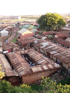
So far, the MKPÆs research team has mapped out the structures, infrastructures and population of Kianda village, located on the west far end of Kibera.
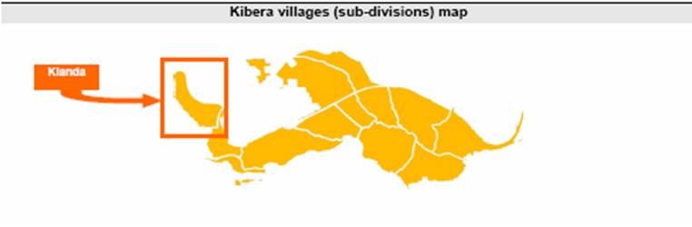
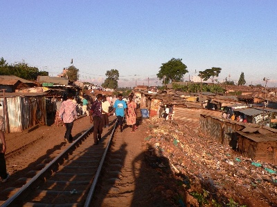
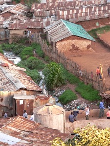
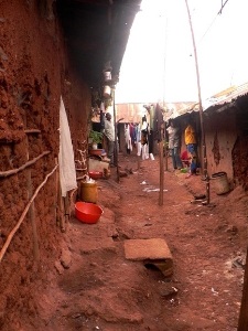
Kianda has got a perimeter of 2 Km and an area of 0.16 sqKm (equal to 15 soccer fields). There is a height difference of 30m between the highest and the lowest point of the terrain. Along the upper side of the hill there is the only asphalt road; at the bottom of the slope a large sewer flows. People there call it ôriverö. The eastern border of Kianda is limited by the railway that runs from Mombasa to Kampala (Uganda). Twice a day, a train slips off the shacks of Kibera, crossing the dreaming eyes of children running out of their classes weaving their hands to the whistling conductor.
A total of 1,500 building has been counted in Kianda: about 1,225 are main structures; the remaining 300 smaller structures are public toilets or baths. Each one of the main structures can contain several households, business and service units. The total number of units is about 5,000: 91.2% are households; 4.6% are business units. About 100 empty units were found. Each residential unit contains an average 1.11 rooms for a total of 5,077 residential rooms.
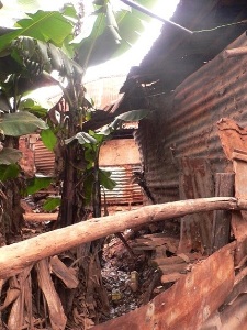
The buildings are made for the most part of mud (71%). About 20% of the rooms are made of sheet iron, 7.6% of wood, and only 2% of concrete stone or bricks.
Less then 3000 units (about 58% of the total) are supplied with electricity. The electricity costs between 200 and 400 Ksh per month per room, and is usually supplied by the landlord. Only a few units are supplied with water. People buy water at the over 115 water points located throughout the village. To fill a 20 litres tank people pay between 5 and 10 Ksh. Each water point serves about 130 people. Kianda has got a drainage system mainly made of so called ôlocalö open drain lines dug in the soil. A shorter part of the system is made of improved open drainages propped up with bricks
and stone panels.
The average rent for one room is about 1,150 Ksh per month. The rent varies from a minimum of 300 to a maximum of 9000 due to several factors: the location of the structure in the area of the village: those that are closer to the sewer in the lower part of the village tend to cost less then those facing the main road. The cost is higher for the rooms used for business. The cost is also linked to the material used to build the structure: those made of concrete are the most expensive ones, followed by the wooden buildings, those made of mud and those built out of iron sheets. Those who settled in Kianda long time ago tend to pay a lower rent then the new-comers. About 4% of the residents are the owners of their house or shop. The total income from the renting business in Kianda can be estimated between 43,000 and 64,000 Ç per month, with an average of about 53,000 Ç per month.
Aside the mapping of the physical features of the settlement, the MKP has taken the census of the population through a door-by-door survey. People count may have been possibly minimally affected and altered due to the fact that the census has been carried out during daytime, while many people were outside working. Whereas people were absent, information about them have been obtained interviewing their neighbours at home (mostly women). Through the systematic use of cross-interviews and by explicitly asking to the interviewee to specify ôthe number of people usually living in the houseö, the researchers have tried to minimize the errors that may possibly come from such issues.
People counted in Kianda are 15,219. The population density is then of 95,120 people per sqKm.
Minors (persons under 18 years of age) constitute 45.5% of the whole population, while adult men and women are respectively 33% and 21.1% of the whole population. Women are 38.7% of the adult population.
Family groups are 4,668, which means that each group is made of an average of 3.25 members. 2,279 of these family groups are headed by a married couple, which means that in Kianda there are 4,558 married people living together (54.9% of the adults); singles unmarried people are 2,689 (32.4 % of the adults); married people with families living away are 531 (6.4%); single parents living with minor children are 518 (6.24%).
As regards the tribal affiliation of the people in Kianda, the vast majority of the families belongs to the Luo tribe (50.2%), followed by Kisiis (15.8%), Luhyas (15.1%), Kambas (9.8%) and Gikuyus (5.7%).
A final estimate
Looking upon the data reported above, and considering that type, dimension and
distribution of the buildings observed in Kianda is typically the same in the whole
slum of Kibera, it is possible to make a guess about the numerical dimension of its
population. Considering that its area of Kibera is set between 2.3 and 2.5 sqKm,
the total population living in the slum can
be most likely estimated between 220,000 and 250,000 people.
|
|
1
|
The Planet of Slums, Mike Davis (2006)
|
|
2
|
Housing Challenges and Opportunities in Sub-Saharan
Africa
|
|
3
|
from unhabitat.org
|
|
4
|
from unhabitat.org
|
|
5
|
from unhabitat.org
|
|
6
|
AFRICA ON THE MOVE - an urban crisis in the
making, by Dr. Anna Kajumulo Tibaijuka
|
|
7
|
During an informal meeting I had on September 2008 with a UN-Habitat officer
working at KENSUP, I was told that the GoK has not yet allowed the release of the
censusÆs outcomes. The UN officer informed me that, according to this census,
people counted in Soweto East came out to be about 20,000. The officer went on
explaining that this outcome did not confirm the former UNÆs estimate of 70,000
people referring to the same village made from the analysis of an aerial picture. In
the same way it was guessed the estimate of 1million people living in the whole
Kibera slum
|
|
8
|
To know more about QGis and download the software, visit qgis.org
|
Last update: 2009-09-13 Back to the list of focus on..
|  |